Your browser doesn't support the features required by impress.js, so you are presented with a simplified version of this presentation.

For the best experience please use the latest Chrome, Safari or Firefox browser.

Basic operations
Data acquisition
How?
Hardware
total station
laser-scan
digital camera
Hardware: the parts of a computer that can be kicked
(Jeff Pesis)
GPS
UAV
Data acquisition
What?
Points and images
Data acquisition
Why?
to virtually recover what 
the archeological excavation is destroying
(primary target)
Data processing
How?
software
1. raw coordinates processing for direct objects visualization 
    (simple and complex geometric shapes)
    
    software: text editor, GIS (or CAD)

2. photomapping

    software: text editor, GIS, raster graphics

3. archeological drawing                      
    (vectorization of georeferenced photomosaics)

    software: GIS (or CAD)

Standar procedures (2D)
1. 3d restitution and mesh editing
    
    software: stereo-photogrammetric applications, SfM/IBM, SVR, mesh editing applications

2. volume calculation

    software: GIS

3. 3d modeling                      

    software: modeler

Advanced techniques (3D)
surfaces
volumes
raw coordinates processing for direct objects visualization 
Standar procedures (2D)
raw data
Standar procedures (2D)
processed data
Standar procedures (2D)
2D view
Standar procedures (2D)
3D view
photomapping
Standar procedures (2D)
raw data
1
zenithal pictures
(photocamera)
2
Ground Control Point
(total station)
Standar procedures (2D)
processed data
3
rectified pictures
Standar procedures (2D)
processed data
4
georeferenced
photomosaic
Standar procedures (2D)
Aramus method
Standar procedures (2D)
archeological drawing
Standar procedures (2D)
raster data
Standar procedures (2D)
vector data
Standar procedures (2D)
database
Advanced techniques (3D)
3D restitution and mesh editing
Advanced techniques (3D)
SfM/IBM
Advanced techniques (3D)
SfM/IBM
Advanced techniques (3D)
voxel graphics
Advanced techniques (3D)
3D modeling
Advanced techniques (3D)
3D modeling
Data processing
What?
different data
(raster, vector and voxel)
in different dimensions 
(2, 3 and 4D)
Data processing
Data processing
2D
3D
4D
Data processing
2D - 3D
Data processing
4D
Data processing
Why?
to create a system able to handle 
different kind of informations
(GIS)
GIS
Data management
How?
GIS and DBMS
Geographic Information System
Data Base Management System
Data management
What?
different kind of information
Data management
Why?
to optimize the research
Data management
Data analysis
How?
software
Data analysis
Statistics
GIS analysis
(anastylosis, building techniques, 
lanscape archeology,
geomorphology, etc...) 
etc...
Anastylosis
Building techniques
Landscape archeology
(vieshed)
Landscape archeology
(CSA + least cost path)
Geomorfology (profiles)
Geomorfology (aspect)
Geomorfology (slope)
Statistics
Statistics
Data analysis
What?
all collected informations and future integrations
(GIS is an open system)
Integration with new data
Data analysis
Why?
to share results with the (scientific) community 
and improve the archeological discipline itself
Internet
Data sharing
How?
publication
Traditional publications
e-publications
Digital fruition of archaeological data
Exhibitions
Data sharing
What?
filtered data and raw data
Filtered data
Raw data
Data sharing
Why?
to propose new hypothesis and 
(at the same time)
give the all the necessary data to verify them
(no dogma, no authority principle)
Science:

Science is an enterprise that builds and organizes knowledge in the form of testable explanations and predictions about the world

(definition from Wikipedia)

Archaeology:

Archeology is the study of past human societies, primarily through the recovery and analysis of the material culture and environmental data which they have left behind, which includes artifacts, architecture, biofacts and cultural landscapes (the archaeological record). Because archaeology employs a wide range of different procedures, it can be considered to be both a science (empiric approach) and a humanity (speculative approach)

(definition from Wikipedia)

Computational archaeology:

What: helps to improve the scientific (empiric) approach to archaeology, which is often understimate

How: grants a more objective data acquisition and processing respects traditional techniques, expecially during the critical phase of the archaeological excavation

Why: unlike scientific experiments, the archaeological excavation is unrepeatible, being the most destructive approach of the archaeological discipline (and, at the same time, the most important)

License:

This work is licensed under a Creative Commons Attribution 4.0 International License.

authors:
Alessandro Bezzi (Arc-Team), Luca Bezzi (Arc-Team)


This is a Free Culture License! 

 Credits

All images come from old Arc-Team's projects led by different institutions:

Universität Innsbruck
Institut füAlte Geschichte und Altorientalistik
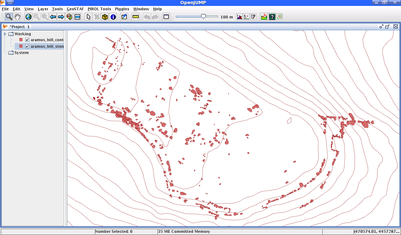
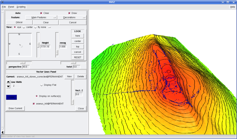
Aramus Excavation and Field school: Sandra Heinsch, Walter Kuntner

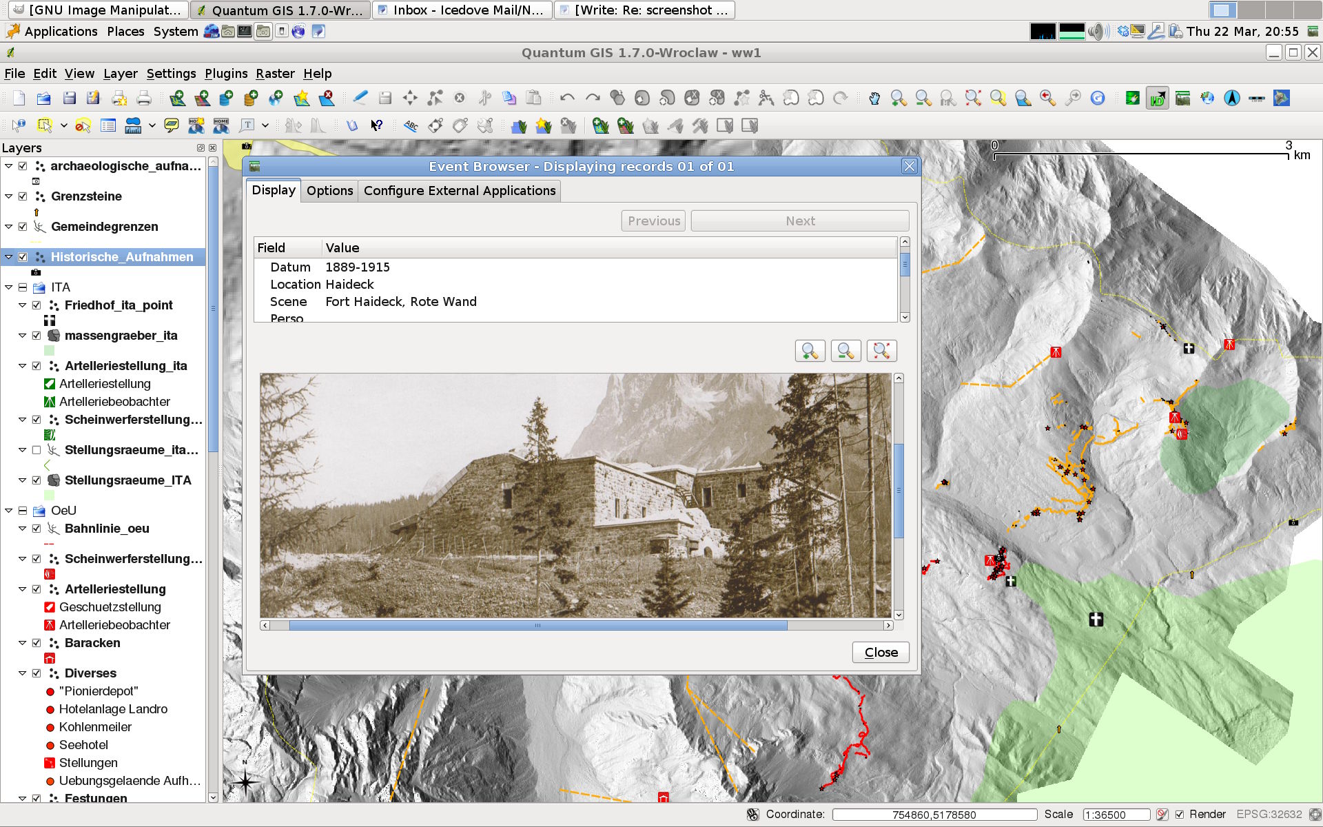
Soprintendenza per i Beni Architettonici e Archeologici di Trento
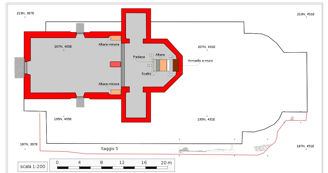
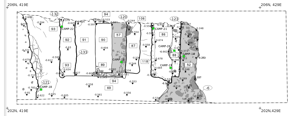
Scavo della chiesa di S. Andrea a Storo: Nicoletta Pisu
Scavo della chiesa di S. Giuseppe a Bosentino: Nicoletta Pisu
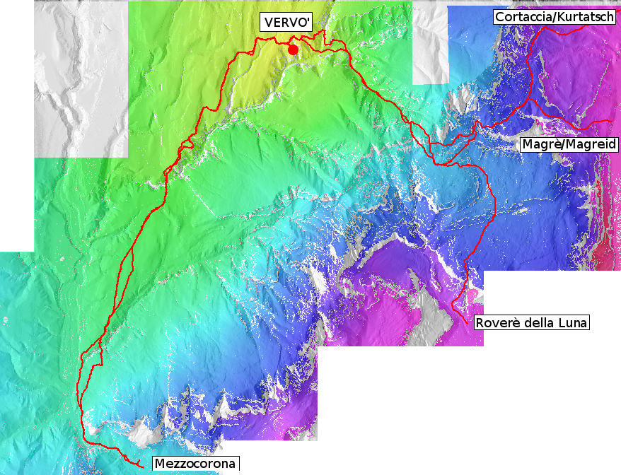
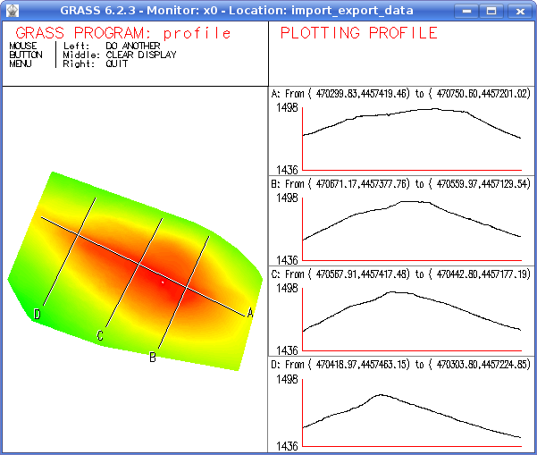
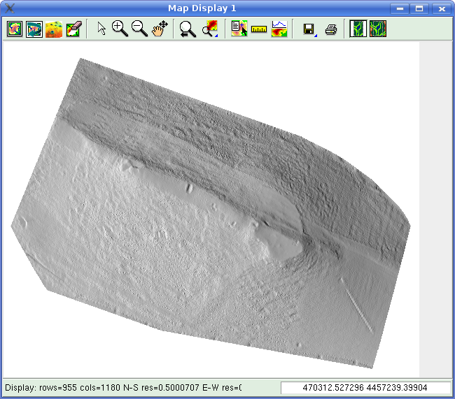
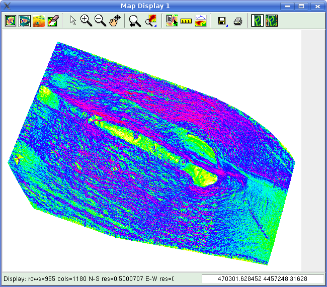
Studi di CSA nel territorio di Vervò: Nicoletta Pisu, Lorenza Endrizzi
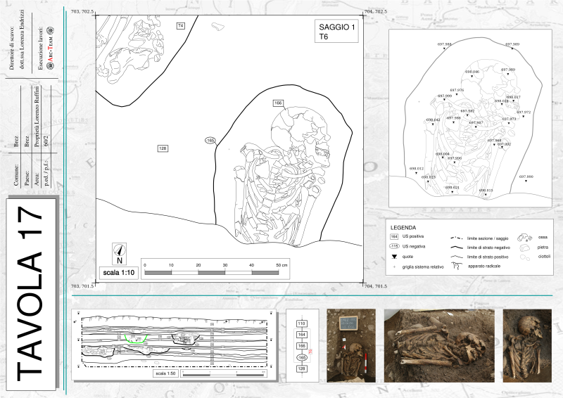
Scavo del sito di Brez: Lorenza Endrizzi
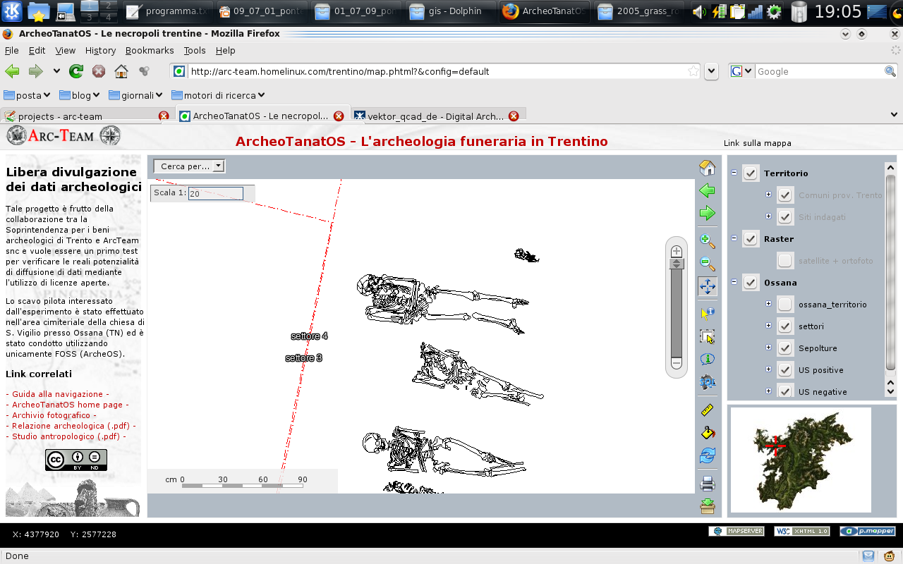
Scavo della chiesa di S. Vigilio ad Ossana:Nicoletta Pisu
Scavo della chiesa di S. Martino di Fondo: Nicoletta Pisu
Progetto di archeologia aerea presso S. Martino di Campi di Riva del Garda: Nicoletta Pisu
Scavo e ricostruzione 4D di Torre dei Sicconi a Caldonazzo: Nicoletta Pisu
Scavo e survey su Monte Rover di Brez: Lorenza Endrizzi
Studio antropologico degli inumati della chiesa di S. Apollinare a Trento: Nicoletta Pisu
Scavo della chiesa di S. Giovanni a Massimeno: Nicoletta Pisu
Scavo della Bastia di Storo: Nicoletta Pisu
Rilievo e analisi sui graffiti dell'eremo di S. Gallo a Cagnò: Nicoletta Pisu
WebGIS per la pubblicazione digitale delle necropoli del Trentino: Nicoletta Pisu
 Credits

All images come from old Arc-Team's projects led by different institutions:

Ufficio Beni Archeologici della Provincia Autonoma di Bolzano
Survey e GIS delle evidenze della Grande Guerra: Catrin Marzoli, Hubert Steiner

Institute Excellent Cluster TOPOI von Berlin
Ricerca sul rilievo 3D: Silvia Polla, Undine Libertwirth

Università degli Studi di Padova
Dipartimento di Archeologia
Scavo microstratigrafico della necropoli del Piovego: Giovanni Leonardi, Michele Cupitò
Scavo della Bastia di Onigo: Guido Rosada, Matteo Frassine
Protoripo di webgis per la valle di Non: Armando Deguio, Franco Nicolis

Università di Pisa
Dipartimento di Scienze Archeologiche
Scavo del sito della Brina a Santo Stefano Magra: Marco Milanese, monica Baldassarri

Università di Udine 
Dipartimento di Scienze Antiche
Rilievo del Mausoleo di Teodorico a Ravenna: Silvia Marchi 

 Credits

All images come from old Arc-Team's projects led by different institutions:

Hansjoerg Thaler
Prospezioni geofisiche nel sito di Grumentum: Hansjoerg Thaler

Museo Antropologico dell'Università di Padova
Creazione di un prototipo per la fruizione di Augmented Reality: Nicola Carrara, Telmo Pievani
Creazione di un prototipo per la fruizione di ologrammi digitali: Nicola Carrara, Telmo Pievani

Use a spacebar or arrow keys to navigate